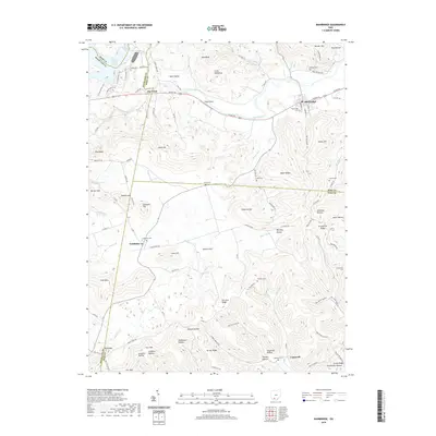
2019 Map of Bainbridge
USGS Topo · Published 2019About this map
Paint Creek flows through the northern reaches of this territory, passing the village of Bainbridge and the small airfield at Haas Airport. The landscape is defined by the intersection of three counties—Ross, Highland, and Pike—where the terrain transitions into a dense network of ridges and hollows such as Whiskey Hollow and Jimtown Hollow. Local genealogy and settlement history are preserved in numerous family-named landmarks and small burial grounds like Jones Cem, Pake Cem, and Garner Cem.
Find a feature on this map
64 named features on this map. Tap any name to fly to it.
Don’t see what you’re looking for? This feature index may not catch every label — zoom into the map to look around manually.
Map Details
Editions of this 2019 Bainbridge Map
This is the sole edition of this map. No revisions or reprints were ever made.
Other maps of this area

1912 · Roxabell
USGS Topo · 1:62,500

1914 · Roxabell
USGS Topo · 1:62,500

1915 · Bainbridge
USGS Topo · 1:48,000

1915 · Piketon
USGS Topo · 1:62,500

1917 · Bainbridge
USGS Topo · 1:62,500

1917 · Piketon
USGS Topo · 1:62,500

1917 · Greenfield
USGS Topo · 1:62,500

1944 · Piketon
USGS Topo · 1:62,500

1944 · Greenfield
USGS Topo · 1:62,500

1944 · Roxabell
USGS Topo · 1:62,500