
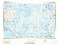
1954 Map of Baird Inlet
USGS Topo · Published 1967About this map
Baird Inlet and the surrounding labyrinth of the Yukon-Kuskokwim Delta are captured here during a period of extensive aerial surveying in the early 1950s. The landscape is defined by an intricate network of water and tundra, featuring the massive Nunavapak Lake and the winding Kuskokwim River to the east. Permanent settlements such as Chefornak and Newtok appear alongside numerous seasonal or historical locations identified as sites, including Chiloghunut and Kealavik. These labels provide a window into the traditional land-use patterns of the Central Yup'ik people. The map also delineates the extensive Clarence Rhode National Wildlife Range Area No 1, highlighting early conservation efforts on Nelson Island and across the delta's wetlands. Significant geographic markers like Erchaktuk Mountain and the Ingariak Hills provide rare elevation in this water-dominated terrain.
Find a feature on this map
97 named features on this map. Tap any name to fly to it.
Don’t see what you’re looking for? This feature index may not catch every label — zoom into the map to look around manually.
Map Details
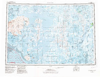
Editions of this 1954 Baird Inlet Map
3 editions found
Other maps of this area

1947 · Russian Mission
USGS Topo · 1:250,000

1950 · Russian Mission
USGS Topo · 1:250,000

1950 · Bethel
USGS Topo · 1:250,000

1951 · Marshall
USGS Topo · 1:250,000

1951 · Kuskokwim Bay
USGS Topo · 1:250,000

1951 · Hooper Bay
USGS Topo · 1:250,000

1951 · Cape Mendenhall
USGS Topo · 1:250,000

1951 · Nunivak Island
USGS Topo · 1:250,000

1951 · Goodnews
USGS Topo · 1:250,000

1951 · Baird Inlet
USGS Topo · 1:250,000