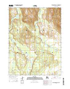
2015 Map of Baird Mountains B-2 SE
USGS Topo · Published 2015About this map
Kobuk Valley National Park encompasses much of this arctic landscape, defined by the winding course of the Salmon River as it moves through the southern and western reaches. The waterway's intricate oxbows and meanders dominate the low-lying terrain, illustrating a wild river system largely untouched by modern development. To the east, the Tutuksuk River flows southward, paralleling the higher ground of the Baird Mountains. In the southwest corner, the Kilik River makes a brief appearance before merging into the broader drainage basin. This 2015 survey reflects a wilderness area preserved for its unique ecological value, where the absence of roads and named settlements highlights the remote character of the Northwest Arctic Borough. The map provides a precise record of these hydrological patterns and the vast protected lands of the Kobuk Valley.
Find a feature on this map
10 named features on this map. Tap any name to fly to it.
Don’t see what you’re looking for? This feature index may not catch every label — zoom into the map to look around manually.
Map Details
Editions of this 2015 Baird Mountains B-2 SE Map
This is the sole edition of this map. No revisions or reprints were ever made.
Other maps of this area

1951 · Baird Mountains
USGS Topo · 1:250,000

1955 · Baird Mountains A-1
USGS Topo · 1:63,360

1955 · Baird Mountains A-2
USGS Topo · 1:63,360

1956 · Baird Mountains
USGS Topo · 1:250,000

1965 · Baird Mountains
USGS Topo · 1:250,000
1990 · Baird Mountains B-1
USGS Topo · 1:63,360
1990 · Baird Mountains B-2
USGS Topo · 1:63,360
2015 · Baird Mountains B-1 NW
USGS Topo · 1:25,000
2015 · Baird Mountains A-2 NW
USGS Topo · 1:25,000
2015 · Baird Mountains B-1 SW
USGS Topo · 1:25,000