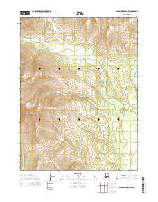
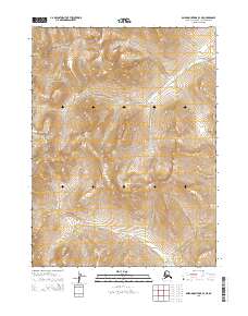
2015 Map of Baird Mountains B-2 SW
USGS Topo · Published 2015About this map
Kobuk Valley National Park encompasses the central portion of this Northwest Arctic landscape, a region defined by its complex hydrography and high-latitude topography. The Kitlik River is the dominant watercourse, winding extensively through the central and northeastern sections of the quadrangle. Its meandering path indicates a relatively low-gradient drainage system within the interior valley, contrasting with the steeper terrain suggested by the surrounding contour patterns. To the east, the Salmon River makes a brief appearance, while the Kallarichuk River defines the southwestern corner. This area remains largely void of human infrastructure or permanent settlements, preserving a snapshot of the Alaskan wilderness where natural boundaries like Township and Range lines are the only markers of administrative organization in an otherwise pristine environment.
Find a feature on this map
10 named features on this map. Tap any name to fly to it.
Don’t see what you’re looking for? This feature index may not catch every label — zoom into the map to look around manually.
Map Details
Editions of this 2015 Baird Mountains B-2 SW Map
This is the sole edition of this map. No revisions or reprints were ever made.
Other maps of this area

1951 · Baird Mountains
USGS Topo · 1:250,000

1955 · Baird Mountains A-2
USGS Topo · 1:63,360

1955 · Baird Mountains B-3
USGS Topo · 1:63,360

1955 · Baird Mountains A-3
USGS Topo · 1:63,360

1956 · Baird Mountains
USGS Topo · 1:250,000

1965 · Baird Mountains
USGS Topo · 1:250,000
1990 · Baird Mountains B-2
USGS Topo · 1:63,360
2015 · Baird Mountains B-2 SE
USGS Topo · 1:25,000
2015 · Baird Mountains A-2 NW
USGS Topo · 1:25,000
2015 · Baird Mountains B-3 NE
USGS Topo · 1:25,000