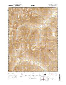
2015 Map of Baird Mountains B-3 NE
USGS Topo · Published 2015About this map
Kobuk Valley National Park encompasses a significant portion of this landscape within the Baird Mountains of northwest Alaska. The topography is defined by the high drainage basins of the Nikok River in the north and the Kitlik River which meanders through the southern sections. This 2015 survey reflects a wilderness largely untouched by permanent settlement or infrastructure, centered on the protected lands and natural watercourses that have historically supported seasonal travel and subsistence in the Arctic. The map highlights the intersection of several township boundaries, including t24n r7w and t23n r6w, providing a clear record of the modern administrative divisions within this protected region of the Northwest Arctic Borough.
Find a feature on this map
8 named features on this map. Tap any name to fly to it.
Don’t see what you’re looking for? This feature index may not catch every label — zoom into the map to look around manually.
Map Details
Editions of this 2015 Baird Mountains B-3 NE Map
This is the sole edition of this map. No revisions or reprints were ever made.
Other maps of this area

1951 · Baird Mountains
USGS Topo · 1:250,000

1955 · Baird Mountains B-3
USGS Topo · 1:63,360

1955 · Baird Mountains C-3
USGS Topo · 1:63,360

1956 · Baird Mountains
USGS Topo · 1:250,000

1965 · Baird Mountains
USGS Topo · 1:250,000
1990 · Baird Mountains B-2
USGS Topo · 1:63,360
1990 · Baird Mountains C-2
USGS Topo · 1:63,360
2015 · Baird Mountains B-3 SW
USGS Topo · 1:25,000
2015 · Baird Mountains B-2 SW
USGS Topo · 1:25,000
2015 · Baird Mountains C-2 SW
USGS Topo · 1:25,000