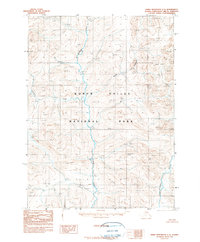
1990 Map of Baird Mountains C-2
USGS Topo · Published 1990About this map
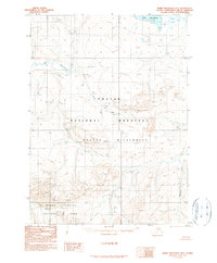
Kobuk Valley National Park dominates this sub-arctic landscape as it was documented in the late 20th century. The terrain is defined by its drainage systems, most notably the Salmon River which winds through the center of the sheet, and the Tutuksuk River visible in the southeast. Smaller tributaries including Sheep Creek and Anaktok Creek carve through the high elevations, which reach heights exceeding 3,000 feet. This 1990 provisional edition was compiled from aerial photography taken a decade prior, capturing the wilderness before any established roads or trails were recorded in this portion of the Northwest Arctic. The map detail reflects a purely natural environment, focused on the complex topography and hydrological patterns of the Baird Mountains.
Find a feature on this map
10 named features on this map. Tap any name to fly to it.
Don’t see what you’re looking for? This feature index may not catch every label — zoom into the map to look around manually.
Map Details
Editions of this 1990 Baird Mountains C-2 Map
This is the sole edition of this map. No revisions or reprints were ever made.
Other maps of this area

1951 · Baird Mountains
USGS Topo · 1:250,000

1955 · Baird Mountains D-3
USGS Topo · 1:63,360

1955 · Baird Mountains B-3
USGS Topo · 1:63,360

1955 · Baird Mountains C-3
USGS Topo · 1:63,360

1956 · Baird Mountains
USGS Topo · 1:250,000

1965 · Baird Mountains
USGS Topo · 1:250,000
1990 · Baird Mountains C-1
USGS Topo · 1:63,360
1990 · Baird Mountains B-1
USGS Topo · 1:63,360
1990 · Baird Mountains B-2
USGS Topo · 1:63,360
1990 · Baird Mountains D-1
USGS Topo · 1:63,360