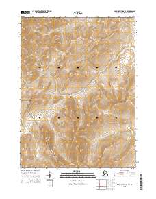
2015 Map of Baird Mountains C-3 SE
USGS Topo · Published 2015About this map
Kobuk Valley National Park encompasses a significant portion of this Arctic landscape, where the high-altitude terrain of the Baird Mountains dictates the local hydrology. This 2015 survey reveals a wilderness defined by steep topographic gradients and the headwaters of the Lekpahlikrak Cr in the southwest corner. The map documents the vast, undeveloped stretches of the Northwest Arctic Borough, organized by the Public Land Survey System grids including t25n r7w and t26n r6w. Without roads or established settlements, the map provides a precise record of the natural landforms and drainage patterns essential for navigating this protected northern ecosystem.
Find a feature on this map
9 named features on this map. Tap any name to fly to it.
Don’t see what you’re looking for? This feature index may not catch every label — zoom into the map to look around manually.
Map Details
Editions of this 2015 Baird Mountains C-3 SE Map
This is the sole edition of this map. No revisions or reprints were ever made.
Other maps of this area

1951 · Baird Mountains
USGS Topo · 1:250,000

1955 · Baird Mountains B-3
USGS Topo · 1:63,360

1955 · Baird Mountains C-3
USGS Topo · 1:63,360

1956 · Baird Mountains
USGS Topo · 1:250,000

1965 · Baird Mountains
USGS Topo · 1:250,000
1990 · Baird Mountains B-2
USGS Topo · 1:63,360
1990 · Baird Mountains C-2
USGS Topo · 1:63,360
2015 · Baird Mountains C-2 NW
USGS Topo · 1:25,000
2015 · Baird Mountains C-3 NE
USGS Topo · 1:25,000
2015 · Baird Mountains B-3 NE
USGS Topo · 1:25,000