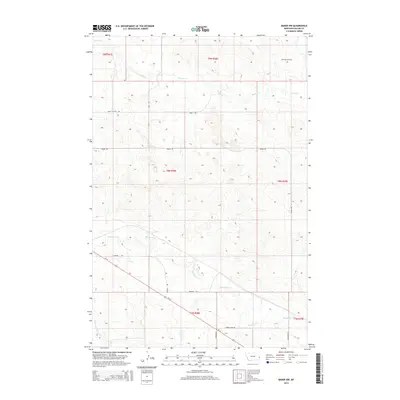
2014 Map of Baker NW
USGS Topo · Published 2014About this map
Monarch Oil Field marks the northern reaches of this Fallon County landscape, indicating the energy-driven economy that defines this portion of eastern Montana. The terrain is structured by a network of drainage systems, including Pennel Cr, Sandstone Cr, and Timber Cr, which carve through the plains. The road network reveals a mix of functional infrastructure and local history, with routes such as Burnt Station Rd, Thiel-Acc-Road, and the historically named Tonquin Trl crossing the township boundaries. Us-12 serves as the primary transportation artery, cutting diagonally through the southern sections. This survey provides a clear view of the rural settlement patterns and industrial footprint in the years following the turn of the 21st century, where large-scale ranching and petroleum extraction coexist on the high plains.
Find a feature on this map
20 named features on this map. Tap any name to fly to it.
Don’t see what you’re looking for? This feature index may not catch every label — zoom into the map to look around manually.
Map Details
Editions of this 2014 Baker NW Map
This is the sole edition of this map. No revisions or reprints were ever made.
Other maps of this area

1953 · Miles City
USGS Topo · 1:250,000

1957 · Miles City
USGS Topo · 1:250,000

1958 · Miles City
USGS Topo · 1:250,000

1981 · Baker
USGS Topo · 1:100,000

1981 · Baker NE
USGS Topo · 1:24,000

1981 · Baker
USGS Topo · 1:24,000

1981 · South Sandstone Reservoir
USGS Topo · 1:24,000

1981 · Lawrence Creek East
USGS Topo · 1:24,000

1981 · Lawrence Creek West
USGS Topo · 1:24,000

1981 · Little Pine Creek
USGS Topo · 1:24,000