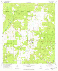
1973 Map of Baker
USGS Topo · Published 1976About this map
Baker stands as the central hub of this north Florida landscape, surrounded by a complex network of waterways feeding the Blackwater River and Yellow River. The area is defined by the heavy presence of the Blackwater River State Forest, where the topography is shaped by countless branches such as Narrows Creek, Threemile Branch, and Penny Creek. This 1973 survey illustrates a rural society organized around small community centers and timber lands, with numerous local landmarks reflecting family and church histories.
Find a feature on this map
51 named features on this map. Tap any name to fly to it.
Don’t see what you’re looking for? This feature index may not catch every label — zoom into the map to look around manually.
Map Details
Editions of this 1973 Baker Map
2 editions found
Other maps of this area

1934 · Holt
USGS Topo · 1:48,000

1934 · Harold
USGS Topo · 1:62,500

1937 · Holt
USGS Topo · 1:62,500

1937 · Harold
USGS Topo · 1:62,500

1938 · Harold
USGS Topo · 1:62,500

1948 · Munson
USGS Topo · 1:62,500

1949 · Crestview
USGS Topo · 1:62,500

1950 · Munson
USGS Topo · 1:62,500

1951 · Crestview
USGS Topo · 1:62,500

1956 · Holt
USGS Topo · 1:62,500