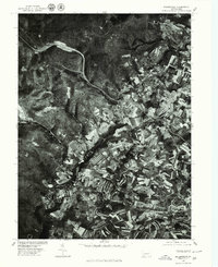
1977 Map of Bakersville
USGS Topo · Published 1979About this map
Bakersville and Lavansville anchor this orthophotographic study of the Somerset County landscape in the late 1970s. The map reveals a distinct contrast between the dense woodlands of Laurel Hill to the west and the intricate patchwork of agricultural fields to the east. The orthophoto format provides a clear view of land-use patterns, showing the precise boundaries of woodlots and the contour-plowed farms surrounding Allenvale and Troytown.
Find a feature on this map
6 named features on this map. Tap any name to fly to it.
Don’t see what you’re looking for? This feature index may not catch every label — zoom into the map to look around manually.
Map Details
Editions of this 1977 Bakersville Map
This is the sole edition of this map. No revisions or reprints were ever made.
Other maps of this area

1913 · Somerset
USGS Topo · 1:62,500

1915 · Somerset
USGS Topo · 1:62,500

1921 · Meyersdale
USGS Topo · 1:62,500

1922 · Confluence
USGS Topo · 1:62,500

1922 · Donegal
USGS Topo · 1:62,500

1931 · Confluence
USGS Topo · 1:62,500

1933 · Confluence
USGS Topo · 1:62,500

1935 · Donegal
USGS Topo · 1:62,500

1939 · Meyersdale
USGS Topo · 1:62,500

1944 · Somerset
USGS Topo · 1:62,500
Featured Places
- Somerset Township, PA
- Milford Township, PA
- Lincoln Township, PA
- Middlecreek Township, PA
- Allenvale, Jefferson Township