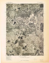
1976 Map of Baldwin SE
USGS Topo · Published 1976About this map
Marlborough stands at the northern edge of this 1976 orthophotoquad, where the wooded landscape of Newaygo County is defined by the winding course of the Pere Marquette River. Unlike a traditional line-drawn topographic map, this aerial perspective reveals the actual density of the forest cover and the precise geometry of agricultural clearings and access roads as they existed in the mid-1970s. The river's path through the northwest corner suggests a corridor of low-lying wetlands and drainage patterns that contrast with the organized grid of upland parcels. This transition from managed timber or farmland into the riparian zone provides a clear look at how human settlement and natural water systems intersected in this part of Michigan during the late twentieth century.
Find a feature on this map
2 named features on this map. Tap any name to fly to it.
Don’t see what you’re looking for? This feature index may not catch every label — zoom into the map to look around manually.
Map Details
Editions of this 1976 Baldwin SE Map
This is the sole edition of this map. No revisions or reprints were ever made.
Other maps of this area

1931 · Baldwin NW
USGS Topo · 1:31,680

1931 · Baldwin NE
USGS Topo · 1:31,680

1932 · Chase NW
USGS Topo · 1:31,680

1954 · Midland
USGS Topo · 1:250,000

1958 · Midland
USGS Topo · 1:250,000

1958 · Woodville
USGS Topo · 1:62,500

1959 · Midland
USGS Topo · 1:250,000

1959 · Reed City
USGS Topo · 1:62,500

1959 · Baldwin
USGS Topo · 1:62,500

1959 · White Cloud
USGS Topo · 1:62,500