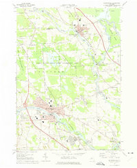
1973 Map of Baldwinsville
USGS Topo · Published 1974About this map
Baldwinsville sits at the convergence of the Seneca River, Oneida River, and Oswego River, a hydrological junction that defined the region's transport history. In the early 1970s, this area shows a landscape transitioning between its canal-era roots and modern development, evidenced by the Lysander New Community and the proximity of the Penn Central and Erie-Lackawanna railroads. The map documents the intricate waterway system including the Oswego Canal and the Erie Canal, which bypasses the river bends near Horseshoe Island. Local genealogy is well-served by numerous burial sites like Riverside Cemetery and Myrtle Grove Cem, along with parish schools such as St Marys Sch. To the north, the Three Rivers State Game Management Area preserves a significant block of open land amidst the growing settlements of Phoenix and Belgium.
Find a feature on this map
88 named features on this map. Tap any name to fly to it.
Don’t see what you’re looking for? This feature index may not catch every label — zoom into the map to look around manually.
Map Details
Editions of this 1973 Baldwinsville Map
Other maps of this area

1895 · Syracuse
USGS Topo · 1:62,500

1898 · Syracuse
USGS Topo · 1:62,500

1900 · Baldwinsville
USGS Topo · 1:62,500

1900 · Fulton
USGS Topo · 1:62,500

1905 · Mexico
USGS Topo · 1:62,500

1939 · Syracuse West
USGS Topo · 1:24,000

1940 · Brewerton
USGS Topo · 1:24,000

1943 · Jordan
USGS Topo · 1:31,680

1943 · Lysander
USGS Topo · 1:31,680

1943 · Brewerton
USGS Topo · 1:31,680