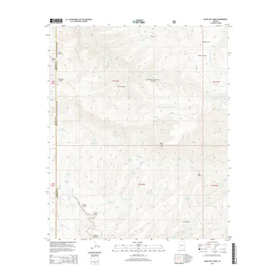
2014 Map of Baldy Bill Point
USGS Topo · Published 2014About this map
Apache National Forest lands dominate this high-country landscape along the Graham and Greenlee county line. The terrain is defined by a dense network of drainages including the N Fork Bear Wallow Cr and S Fork Bear Wallow Cr, which converge near Schell Canyon. This 2014 survey reveals a landscape heavily managed for water resources, documented by numerous named cattle tanks and springs that support the regional ranching economy. Features like Turkey Trap Tank, Cowhead Tank, and Upper Malay Tank are scattered across the canyons, while Chitty Falls provides a rare hydrologic landmark in the southern reaches. The map captures the remote nature of the region, where access is limited to forest routes like Co RD 25 and Co RD 54, serving as a detailed record of the geography surrounding the prominent Baldy Bill Point.
Find a feature on this map
58 named features on this map. Tap any name to fly to it.
Don’t see what you’re looking for? This feature index may not catch every label — zoom into the map to look around manually.
Map Details
Editions of this 2014 Baldy Bill Point Map
This is the sole edition of this map. No revisions or reprints were ever made.
Other maps of this area

1913 · Morenci
USGS Topo · 1:125,000

1915 · Morenci
USGS Topo · 1:125,000

1922 · Nutrioso
USGS Topo · 1:125,000

1954 · Clifton
USGS Topo · 1:250,000

1957 · Clifton
USGS Topo · 1:250,000

1958 · Clifton
USGS Topo · 1:250,000

1958 · Hannagan Meadow
USGS Topo · 1:62,500

1962 · Clifton
USGS Topo · 1:250,000

1967 · Freezeout Mountain
USGS Topo · 1:24,000

1967 · Robinson Mesa
USGS Topo · 1:24,000