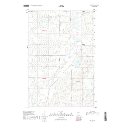
2019 Map of Ball Bluff
USGS Topo · Published 2019About this map
The Mississippi River meanders sharply through this Aitkin County landscape, defining the character of the region as it flows past the small community of Jacobson. The terrain is marked by the significant rise of Ball Bluff, which overlooks a dense network of wetlands and small water bodies including Ball Bluff Lake and Blackface Lake. Human presence is concentrated along the Great River RD, with established landmarks such as the Ball Bluff Cem and Verdon Cem serving as important touchpoints for genealogical research.
Find a feature on this map
31 named features on this map. Tap any name to fly to it.
Don’t see what you’re looking for? This feature index may not catch every label — zoom into the map to look around manually.
Map Details
Editions of this 2019 Ball Bluff Map
This is the sole edition of this map. No revisions or reprints were ever made.
Other maps of this area

1953 · Duluth
USGS Topo · 1:250,000

1954 · Hibbing
USGS Topo · 1:250,000

1957 · Hibbing
USGS Topo · 1:250,000

1958 · Hibbing
USGS Topo · 1:250,000

1958 · Duluth
USGS Topo · 1:250,000

1964 · Hibbing
USGS Topo · 1:250,000

1970 · Split Hand Lake
USGS Topo · 1:24,000

1970 · Rabey
USGS Topo · 1:24,000
1970 · Swan River
USGS Topo · 1:24,000

1970 · Sanders Lake
USGS Topo · 1:24,000