
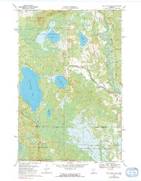
1970 Map of Split Hand Lake
USGS Topo · Published 1972About this map
Golden Anniversary State Forest and its neighboring preserves dominate this Itasca County landscape, where the Mississippi River carves a highly sinuous path through the northeastern corner. The terrain is defined by a dense network of glacial water bodies, most notably the expansive Split Hand Lake and the smaller Little Split Hand Lake at its eastern flank. This 1970 field-checked survey captures the area at a time when road infrastructure was limited to light-duty and unimproved routes, alongside a dedicated Winter Trail designed for seasonal access through the wetlands.
Find a feature on this map
15 named features on this map. Tap any name to fly to it.
Don’t see what you’re looking for? This feature index may not catch every label — zoom into the map to look around manually.
Map Details
Editions of this 1970 Split Hand Lake Map
2 editions found
Other maps of this area

1953 · Grand Rapids
USGS Topo · 1:24,000

1953 · Duluth
USGS Topo · 1:250,000

1954 · Hibbing
USGS Topo · 1:250,000

1957 · Hibbing
USGS Topo · 1:250,000

1958 · Hibbing
USGS Topo · 1:250,000

1958 · Duluth
USGS Topo · 1:250,000

1964 · Hibbing
USGS Topo · 1:250,000

1969 · La Prairie
USGS Topo · 1:24,000
1970 · Warba
USGS Topo · 1:24,000

1970 · Rabey
USGS Topo · 1:24,000