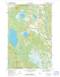
1970 Map of Split Hand Lake
USGS Topo · Published 1991About this map
The Mississippi River meanders through a labyrinth of wetlands and glacial lakes in this northern Minnesota landscape, captured during a 1970 field check. Three significant protected areas converge here: the Golden Anniversary State Forest, Hill River State Forest, and Savanna State Forest. This intersection of state-managed lands highlights the region's importance for timber and conservation in the mid-century era.
Find a feature on this map
16 named features on this map. Tap any name to fly to it.
Don’t see what you’re looking for? This feature index may not catch every label — zoom into the map to look around manually.
Map Details
Editions of this 1970 Split Hand Lake Map
2 editions found
Other maps of this area

1953 · Grand Rapids
USGS Topo · 1:24,000

1953 · Duluth
USGS Topo · 1:250,000

1954 · Hibbing
USGS Topo · 1:250,000

1957 · Hibbing
USGS Topo · 1:250,000

1958 · Hibbing
USGS Topo · 1:250,000

1958 · Duluth
USGS Topo · 1:250,000

1964 · Hibbing
USGS Topo · 1:250,000

1969 · La Prairie
USGS Topo · 1:24,000
1970 · Warba
USGS Topo · 1:24,000

1970 · Split Hand Lake
USGS Topo · 1:24,000