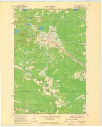
1970 Map of Swan River
USGS Topo · Published 1972About this map
Swan River serves as the central hub of this northern Minnesota landscape, situated at the junction of the Burlington Northern railroad lines. The topography is defined by the winding course of the Swan River and the Libby Branch, which meander through a patchwork of marshlands and timbered sections across the border of Itasca and Aitkin Counties. The presence of a local Townhall and the Sago Cem south of the main settlement indicates a established rural community structure during this period.
Find a feature on this map
26 named features on this map. Tap any name to fly to it.
Don’t see what you’re looking for? This feature index may not catch every label — zoom into the map to look around manually.
Map Details
Editions of this 1970 Swan River Map
This is the sole edition of this map. No revisions or reprints were ever made.
Other maps of this area

1953 · Duluth
USGS Topo · 1:250,000

1954 · Hibbing
USGS Topo · 1:250,000

1957 · Hibbing
USGS Topo · 1:250,000

1958 · Hibbing
USGS Topo · 1:250,000

1958 · Duluth
USGS Topo · 1:250,000

1964 · Hibbing
USGS Topo · 1:250,000

1969 · Wawina
USGS Topo · 1:24,000
1969 · Floodwood Lake
USGS Topo · 1:24,000
1969 · Goodland
USGS Topo · 1:24,000

1969 · Island
USGS Topo · 1:24,000