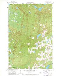
1969 Map of Goodland
USGS Topo · Published 1972About this map
Goodland serves as the primary hub in this portion of Itasca County, situated amidst a dense network of glacial lakes and wetlands. The landscape is defined by its water bodies, ranging from the uniquely named Pancake Lake in the south to the northern waters of Lammon Aid Lake and Hart Lake. A small Landing Field near New Lake indicates the area's integration into regional transport beyond the local road network. The map reveals a transition in land use, showing industrial activity at a Gravel Pit northeast of the main settlement. Civil divisions are clearly marked, including the boundaries of Feeley and Goodland townships, while waterways like Rosholt Creek and Spring Creek drain the surrounding marshes and low-lying terrain.
Find a feature on this map
15 named features on this map. Tap any name to fly to it.
Don’t see what you’re looking for? This feature index may not catch every label — zoom into the map to look around manually.
Map Details
Editions of this 1969 Goodland Map
This is the sole edition of this map. No revisions or reprints were ever made.
Other maps of this area

1920 · Trout Lake
USGS Topo · 1:62,500

1952 · Silica
USGS Topo · 1:24,000

1952 · Calumet
USGS Topo · 1:24,000

1952 · Pengilly
USGS Topo · 1:24,000

1954 · Hibbing
USGS Topo · 1:250,000

1957 · Hibbing
USGS Topo · 1:250,000

1958 · Hibbing
USGS Topo · 1:250,000

1964 · Hibbing
USGS Topo · 1:250,000

1969 · Wawina
USGS Topo · 1:24,000
1969 · Floodwood Lake
USGS Topo · 1:24,000