
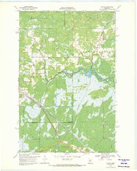
1969 Map of Wawina
USGS Topo · Published 1971About this map
Low-lying marshlands and river bottomlands define this northern Minnesota landscape where the West Branch Floodwood River meets the main Floodwood River. The small settlement of Wawina is situated at the intersection of the Burlington Northern railroad and the county lines, serving as a focal point for the surrounding rural townships. The map illustrates a community shaped by its hydrology, with significant portions of the south dedicated to the Savanna State Forest.
Find a feature on this map
17 named features on this map. Tap any name to fly to it.
Don’t see what you’re looking for? This feature index may not catch every label — zoom into the map to look around manually.
Map Details
Editions of this 1969 Wawina Map
2 editions found
Other maps of this area

1953 · Duluth
USGS Topo · 1:250,000

1954 · Hibbing
USGS Topo · 1:250,000

1957 · Hibbing
USGS Topo · 1:250,000

1958 · Hibbing
USGS Topo · 1:250,000

1958 · Duluth
USGS Topo · 1:250,000

1963 · Toivola SW
USGS Topo · 1:24,000

1963 · Upstead Lake
USGS Topo · 1:24,000
1963 · Floodwood
USGS Topo · 1:24,000

1964 · Hibbing
USGS Topo · 1:250,000
1969 · Floodwood Lake
USGS Topo · 1:24,000