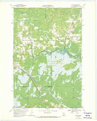
1969 Map of Wawina
USGS Topo · Published 1971About this map
The settlement of Wawina serves as a small rail and local hub along the Burlington Northern line in the late 1960s. This Northern Minnesota landscape is defined by the convergence of the West Branch Floodwood River and the Floodwood River, which wind through a mosaic of wetlands and timbered terrain. The social structure of the rural community is evidenced by the presence of a Townhall, Community Hall, and Apostolic Ch, alongside the Cedar Valley Cem and Wawina Ch.
Find a feature on this map
16 named features on this map. Tap any name to fly to it.
Don’t see what you’re looking for? This feature index may not catch every label — zoom into the map to look around manually.
Map Details
Editions of this 1969 Wawina Map
2 editions found
Other maps of this area

1953 · Duluth
USGS Topo · 1:250,000

1954 · Hibbing
USGS Topo · 1:250,000

1957 · Hibbing
USGS Topo · 1:250,000

1958 · Hibbing
USGS Topo · 1:250,000

1958 · Duluth
USGS Topo · 1:250,000

1963 · Toivola SW
USGS Topo · 1:24,000

1963 · Upstead Lake
USGS Topo · 1:24,000
1963 · Floodwood
USGS Topo · 1:24,000

1964 · Hibbing
USGS Topo · 1:250,000

1969 · Wawina
USGS Topo · 1:24,000