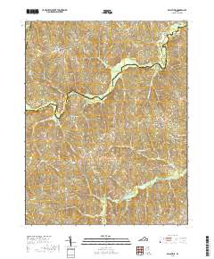
2019 Map of Ballsville
USGS Topo · Published 2019About this map
Clementown Mills and the small settlements of Lodore and Haw Branch anchor this rural landscape along the borders of Amelia, Powhatan, and Cumberland counties. The terrain is defined by the winding course of the Appomattox River in the northeast and a dense network of watercourses including Flat Creek, Horsepen Cr, and Moore Cr. Evidence of the area's agricultural and local heritage is preserved in the road network, which includes historical thoroughfares like Old Buckingham Rd and Genito Rd. Genealogists may find particular interest in the location of Piedmont Cem and Flower Hill Cem, while the inclusion of sites like Paineville and Tobaccoville reflects the enduring character of these central Virginia crossroads communities.
Find a feature on this map
46 named features on this map. Tap any name to fly to it.
Don’t see what you’re looking for? This feature index may not catch every label — zoom into the map to look around manually.
Map Details
Editions of this 2019 Ballsville Map
This is the sole edition of this map. No revisions or reprints were ever made.
Other maps of this area

1890 · Goochland
USGS Topo · 1:125,000

1891 · Palmyra
USGS Topo · 1:125,000

1891 · Farmville
USGS Topo · 1:125,000

1892 · Goochland
USGS Topo · 1:125,000

1893 · Farmville
USGS Topo · 1:125,000

1895 · Palmyra
USGS Topo · 1:125,000

1897 · Amelia
USGS Topo · 1:125,000

1897 · Palmyra
USGS Topo · 1:125,000

1943 · Powhatan
USGS Topo · 1:31,680

1943 · Amelia
USGS Topo · 1:31,680