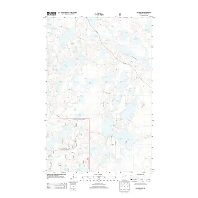
2013 Map of Balsam Lake
USGS Topo · Published 2013About this map
Chippewa National Forest encompasses the southern half of this landscape, where a complex network of glacial lakes and wetlands defines the terrain. The northern portion is marked by the Scenic Hwy and Long Lake Forest Rd, which navigate around prominent water bodies like Eagle Lake and Birch Lake. Genealogists will find the Teigland Family Cem located near Nickel Lake, while the Balsam Cem sits further south near the shores of Balsam Lake. The hydrological pattern is intricate, showing the headwaters and drainage of the W Fork Prairie River alongside uniquely named features such as Gunny Sack Lake and White Porky Lake. This 2013 survey illustrates the modern configuration of forest service roads and trails, including the Wilderness Trl, that provide access to this water-dominated region of Itasca County.
Find a feature on this map
68 named features on this map. Tap any name to fly to it.
Don’t see what you’re looking for? This feature index may not catch every label — zoom into the map to look around manually.
Map Details
Editions of this 2013 Balsam Lake Map
This is the sole edition of this map. No revisions or reprints were ever made.
Other maps of this area

1919 · Release
USGS Topo · 1:62,500

1919 · Marcell
USGS Topo · 1:62,500

1920 · Trout Lake
USGS Topo · 1:62,500

1943 · Release
USGS Topo · 1:62,500

1954 · Hibbing
USGS Topo · 1:250,000

1957 · Hibbing
USGS Topo · 1:250,000

1958 · Hibbing
USGS Topo · 1:250,000

1964 · Hibbing
USGS Topo · 1:250,000

1970 · Wabana Lake
USGS Topo · 1:24,000

1970 · Clubhouse Lake
USGS Topo · 1:24,000