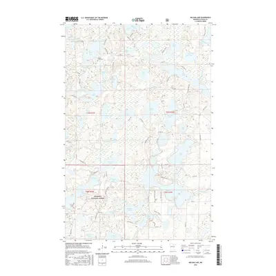
2016 Map of Balsam Lake
USGS Topo · Published 2016About this map
Chippewa National Forest encompasses the southern half of this landscape, where the terrain is dominated by a dense network of glacial lakes and wetlands. The intricate waterway system includes distinctive names such as Gunny Sack Lake, White Swan Lake, and Marble Lake, connected by forest roads and trails like the Wilderness Trl and Eagle Lake Pines. This 2016 survey illustrates a region largely dedicated to timber and recreation, yet small markers of local genealogy remain. The Teigland Family Cem sits near Eagle Lake, while the Balsam Cem is located further south near W Big Balsam Rd. The map also traces the path of the Scenic Hwy as it cuts through the northern section, providing access to Antler Lake and Spruce Lake. The abundance of small, isolated basins like Stumple Lake and Little Otter Lake reflects the post-glacial topography characteristic of the Itasca County wilderness.
Find a feature on this map
96 named features on this map. Tap any name to fly to it.
Don’t see what you’re looking for? This feature index may not catch every label — zoom into the map to look around manually.
Map Details
Editions of this 2016 Balsam Lake Map
This is the sole edition of this map. No revisions or reprints were ever made.
Other maps of this area

1919 · Release
USGS Topo · 1:62,500

1919 · Marcell
USGS Topo · 1:62,500

1920 · Trout Lake
USGS Topo · 1:62,500

1943 · Release
USGS Topo · 1:62,500

1954 · Hibbing
USGS Topo · 1:250,000

1957 · Hibbing
USGS Topo · 1:250,000

1958 · Hibbing
USGS Topo · 1:250,000

1964 · Hibbing
USGS Topo · 1:250,000

1970 · Wabana Lake
USGS Topo · 1:24,000

1970 · Clubhouse Lake
USGS Topo · 1:24,000