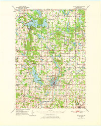
1950 Map of Balsam Lake
USGS Topo · Published 1976About this map
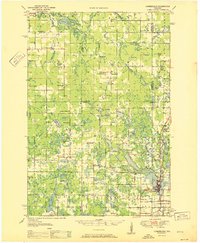
Glacial lakes and small rural communities define this mid-century portrait of Polk County, centered on the village of Balsam Lake. The landscape is a complex network of water bodies, including Wapogasset Lake and the irregular shoreline of Balsam Lake itself, which features landmarks like Paradise Island and Cedar Lake. This era shows a high density of rural education, with one-room schoolhouses like Goose Lake Sch and Apple River Valley Sch still serving the farming townships.
Find a feature on this map
121 named features on this map. Tap any name to fly to it.
Don’t see what you’re looking for? This feature index may not catch every label — zoom into the map to look around manually.
Map Details
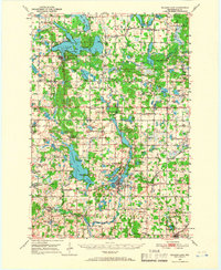
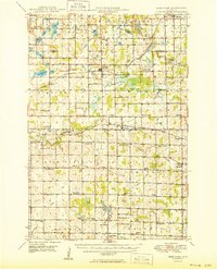
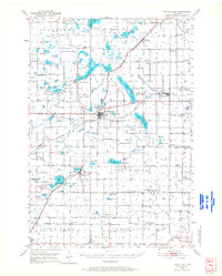
Editions of this 1950 Balsam Lake Map
3 editions found
Other maps of this area

1900 · St Croix Dalles
USGS Topo · 1:62,500

1901 · St Croix Dalles
USGS Topo · 1:62,500

1948 · New Richmond
USGS Topo · 1:62,500

1948 · Downing
USGS Topo · 1:62,500

1949 · New Richmond
USGS Topo · 1:62,500

1950 · Downing
USGS Topo · 1:62,500
1950 · Deer Park
USGS Topo · 1:62,500

1950 · Balsam Lake
USGS Topo · 1:62,500
1950 · Turtle Lake
USGS Topo · 1:62,500
1951 · Cumberland
USGS Topo · 1:48,000