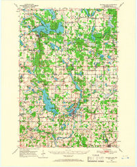
1950 Map of Balsam Lake
USGS Topo · Published 1966About this map
Balsam Lake serves as the focal point for this mid-century look at Polk County, Wisconsin, where the namesake county seat is surrounded by a dense network of glacial lakes and small farming townships. The map documents the extensive rural school system of the era, including the Sucker Lake Sch (Abandoned) and Bear Lake Sch, many of which were the heart of local districts like Georgetown and Johnstown.
Find a feature on this map
125 named features on this map. Tap any name to fly to it.
Don’t see what you’re looking for? This feature index may not catch every label — zoom into the map to look around manually.
Map Details
Editions of this 1950 Balsam Lake Map
3 editions found
Other maps of this area

1900 · St Croix Dalles
USGS Topo · 1:62,500

1901 · St Croix Dalles
USGS Topo · 1:62,500

1948 · New Richmond
USGS Topo · 1:62,500

1948 · Downing
USGS Topo · 1:62,500

1949 · New Richmond
USGS Topo · 1:62,500

1950 · Downing
USGS Topo · 1:62,500

1950 · Deer Park
USGS Topo · 1:62,500

1950 · Balsam Lake
USGS Topo · 1:62,500

1950 · Turtle Lake
USGS Topo · 1:62,500

1951 · Cumberland
USGS Topo · 1:48,000