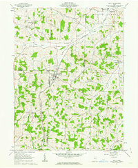
1961 Map of Baltic
USGS Topo · Published 1963About this map
Baltic serves as the focal point for this 1961 topographical survey, situated at the intersection of Tuscarawas, Coshocton, and Holmes counties. The village sits in a valley formed by Brush Run, while the surrounding hill country is dotted with local institutions like the Grange Hall and Baltic Ch. The landscape reflects an economy balanced between agriculture and mineral extraction, with a Shale Pit and Clay Pit Kilns located near the town center, and various Strip Mine operations scattered across the eastern ridges in Auburn and Bucks townships.
Find a feature on this map
38 named features on this map. Tap any name to fly to it.
Don’t see what you’re looking for? This feature index may not catch every label — zoom into the map to look around manually.
Map Details
Editions of this 1961 Baltic Map
2 editions found
Other maps of this area

1911 · Newcomerstown
USGS Topo · 1:62,500

1913 · Newcomerstown
USGS Topo · 1:62,500

1913 · Coshocton
USGS Topo · 1:62,500

1914 · Navarre
USGS Topo · 1:62,500

1915 · Millersburg
USGS Topo · 1:62,500

1915 · Coshocton
USGS Topo · 1:62,500

1943 · Millersburg
USGS Topo · 1:62,500

1943 · Coshocton
USGS Topo · 1:62,500

1943 · Newcomerstown
USGS Topo · 1:62,500

1944 · Navarre
USGS Topo · 1:62,500