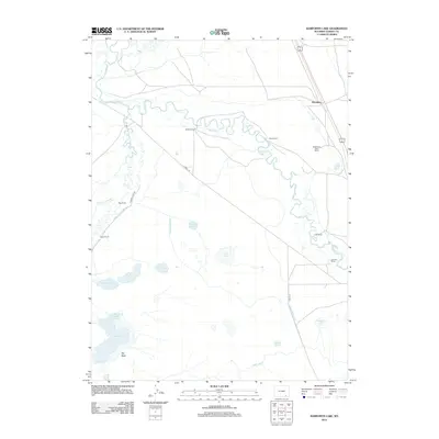
2012 Map of Bamforth Lake
USGS Topo · Published 2012About this map
Biddick Ranch and Oasis Ranch anchor this ranching landscape along the winding course of the Laramie River. The area is defined by an extensive network of water management features, including the Biddick Ditch and the North Canal, which support agriculture in this high-plains environment. The terrain is marked by numerous natural depressions and seasonal water bodies, most notably Bamforth Lake and the Big Basin to the south.
Find a feature on this map
27 named features on this map. Tap any name to fly to it.
Don’t see what you’re looking for? This feature index may not catch every label — zoom into the map to look around manually.
Map Details
Editions of this 2012 Bamforth Lake Map
This is the sole edition of this map. No revisions or reprints were ever made.
Other maps of this area

1895 · Laramie
USGS Topo · 1:125,000

1902 · Laramie
USGS Topo · 1:125,000

1905 · Laramie
USGS Topo · 1:125,000

1906 · Laramie
USGS Topo · 1:125,000

1908 · Laramie
USGS Topo · 1:125,000

1954 · Cheyenne
USGS Topo · 1:250,000

1955 · Bosler
USGS Topo · 1:24,000

1955 · Bosler SE
USGS Topo · 1:24,000

1955 · Cooper Lake South
USGS Topo · 1:24,000

1958 · Cheyenne
USGS Topo · 1:250,000