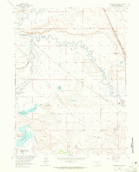
1963 Map of Bamforth Lake
USGS Topo · Published 1965About this map
The Bamforth National Wildlife Refuge anchors the southern portion of this high-plains landscape, where the waters of the Laramie River and Little Laramie River converge. This early 1960s survey documents a highly managed hydrological environment, defined by an intricate network of irrigation channels such as the Oasis Ditch, Biddick Ditch, and North Fork Canal. These systems sustained a series of established family livestock operations, including the Biddick Ranch, Oasis Ranch, and Carroll Ranch.
Find a feature on this map
31 named features on this map. Tap any name to fly to it.
Don’t see what you’re looking for? This feature index may not catch every label — zoom into the map to look around manually.
Map Details
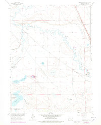
Editions of this 1963 Bamforth Lake Map
2 editions found
Other maps of this area

1895 · Laramie
USGS Topo · 1:125,000

1902 · Laramie
USGS Topo · 1:125,000

1905 · Laramie
USGS Topo · 1:125,000

1906 · Laramie
USGS Topo · 1:125,000

1908 · Laramie
USGS Topo · 1:125,000

1954 · Cheyenne
USGS Topo · 1:250,000

1955 · Bosler
USGS Topo · 1:24,000

1955 · Bosler SE
USGS Topo · 1:24,000

1955 · Cooper Lake South
USGS Topo · 1:24,000

1958 · Cheyenne
USGS Topo · 1:250,000