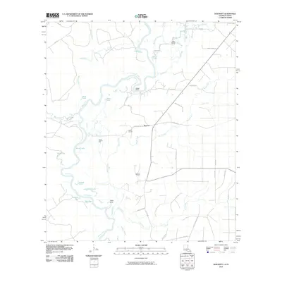
2010 Map of Bancroft
USGS Topo · Published 2010About this map
The Sabine River winds through the borderlands between Louisiana and Texas, creating a complex geography of oxbows and riparian wetlands. Deep within the bottomlands of Beauregard Parish, the river's path is defined by prominent features such as Snider Bend and Taylor Bend, which have historically influenced local property lines and settlement patterns. The landscape is dotted with numerous bodies of water, including Sime Lake, Duck Lake, and Skinner Lake, reflecting the dynamic nature of this riverine environment.
Find a feature on this map
49 named features on this map. Tap any name to fly to it.
Don’t see what you’re looking for? This feature index may not catch every label — zoom into the map to look around manually.
Map Details
Editions of this 2010 Bancroft Map
This is the sole edition of this map. No revisions or reprints were ever made.
Other maps of this area

1935 · Wilson Lake
USGS Topo · 1:31,680

1947 · Carter Creek
USGS Topo · 1:31,680

1947 · Wilson Lake
USGS Topo · 1:31,680

1947 · Hyatt
USGS Topo · 1:31,680

1947 · Bivens
USGS Topo · 1:31,680

1947 · Long Marsh
USGS Topo · 1:31,680

1949 · Bancroft
USGS Topo · 1:31,680

1952 · Lake Charles
USGS Topo · 1:250,000
1954 · Bivens
USGS Topo · 1:31,680

1954 · Lake Charles
USGS Topo · 1:250,000