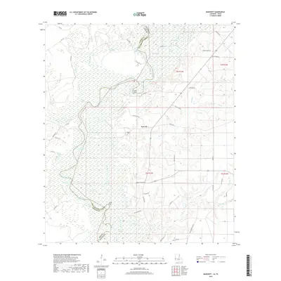
2018 Map of Bancroft
USGS Topo · Published 2018About this map
The Sabine River forms a winding natural border between Texas and Louisiana on this 2018 survey, defining a landscape of dense wetlands and oxbow formations. In the heart of this riverine environment, the small settlement of Bancroft is surrounded by a complex network of sloughs and lakes, including Rattlesnake Slough, Bee Slough, and Sydney Lake. These water bodies, along with prominent river features like Snider Bend and Taylor Bend, indicate a terrain shaped by historical shifts in the river's course. Local family names are deeply etched into the geography through numerous private and parish roads such as Fred Spikes Rd, Monroe Whitman Rd, and Thomas Warden Rd. For those researching regional genealogy, the Spikes Cem near the center of the quadrangle serves as a primary point of interest among the many creeks and branches, such as Donahoe Creek and Simms Branch, that drain into the bottomlands.
Find a feature on this map
68 named features on this map. Tap any name to fly to it.
Don’t see what you’re looking for? This feature index may not catch every label — zoom into the map to look around manually.
Map Details
Editions of this 2018 Bancroft Map
This is the sole edition of this map. No revisions or reprints were ever made.
Other maps of this area

1935 · Wilson Lake
USGS Topo · 1:31,680

1947 · Carter Creek
USGS Topo · 1:31,680

1947 · Wilson Lake
USGS Topo · 1:31,680

1947 · Hyatt
USGS Topo · 1:31,680

1947 · Bivens
USGS Topo · 1:31,680

1947 · Long Marsh
USGS Topo · 1:31,680

1949 · Bancroft
USGS Topo · 1:31,680

1952 · Lake Charles
USGS Topo · 1:250,000
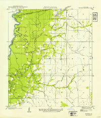
1954 · Bivens
USGS Topo · 1:31,680

1954 · Lake Charles
USGS Topo · 1:250,000