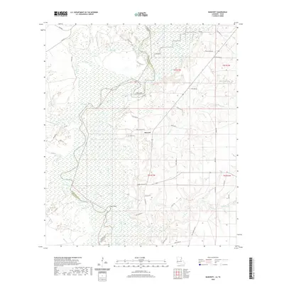
2020 Map of Bancroft
USGS Topo · Published 2020About this map
Bancroft serves as the central hub of this low-lying landscape along the winding Sabine River, which defines the border between Louisiana and Texas. The terrain is characterized by an intricate network of oxbow lakes, sloughs, and bayous that suggest a dynamic river history. Named features like Snider Bend and Taylor Bend highlight the river's meandering path, while numerous water bodies such as Sydney Lake, Lower Circle Lake, and Duck Roost Lake pockmark the floodplain. Local family and community history is anchored by the presence of Spikes Cem, located just west of the main settlement area. The map reveals a rural infrastructure of winding parish roads and timber-access routes, including Sam Smith Rd and Monroe Whitman Rd, which navigate the wetlands and timberlands surrounding Alligator Slough and Big Slough.
Find a feature on this map
68 named features on this map. Tap any name to fly to it.
Don’t see what you’re looking for? This feature index may not catch every label — zoom into the map to look around manually.
Map Details
Editions of this 2020 Bancroft Map
This is the sole edition of this map. No revisions or reprints were ever made.
Other maps of this area

1935 · Wilson Lake
USGS Topo · 1:31,680

1947 · Carter Creek
USGS Topo · 1:31,680

1947 · Wilson Lake
USGS Topo · 1:31,680

1947 · Hyatt
USGS Topo · 1:31,680

1947 · Bivens
USGS Topo · 1:31,680

1947 · Long Marsh
USGS Topo · 1:31,680

1949 · Bancroft
USGS Topo · 1:31,680

1952 · Lake Charles
USGS Topo · 1:250,000
1954 · Bivens
USGS Topo · 1:31,680

1954 · Lake Charles
USGS Topo · 1:250,000