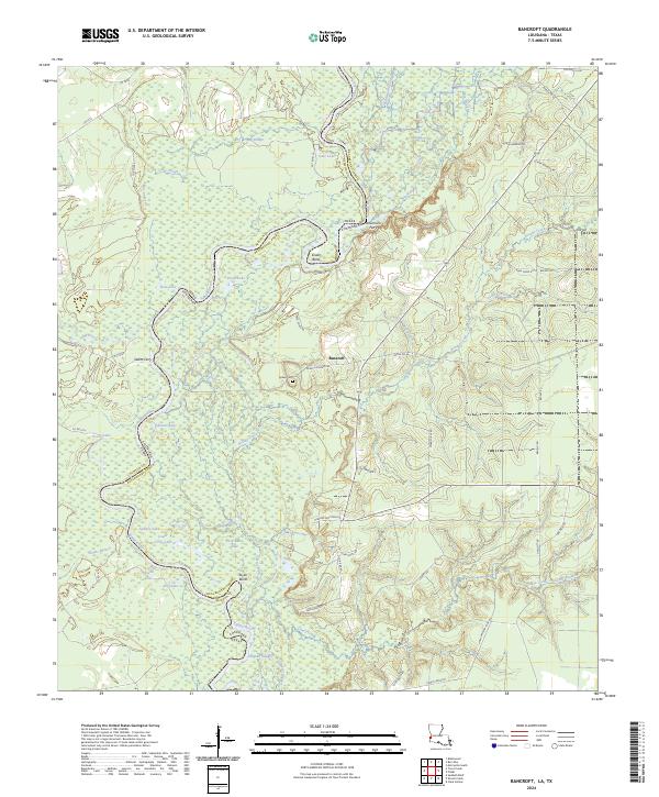
2024 Map of Bancroft
USGS Topo · Published 2024About this map
The Sabine River snakes along the border of Newton County and Beauregard Parish, defining a landscape of dense backwaters and bayous. This area, located near the settlement of Bancroft, is characterized by a complex network of oxbow lakes including Lower Circle Lake, Sydney Lake, and Bose Lake. The river's influence is evident in the named meanders like Snider Bend and Taylor Bend, which have historically dictated the location of river crossings such as Whitmans Ferry and Salem Ferry.
Find a feature on this map
72 named features on this map. Tap any name to fly to it.
Don’t see what you’re looking for? This feature index may not catch every label — zoom into the map to look around manually.
Map Details
Editions of this 2024 Bancroft Map
This is the sole edition of this map. No revisions or reprints were ever made.
Other maps of this area

1935 · Wilson Lake
USGS Topo · 1:31,680

1947 · Carter Creek
USGS Topo · 1:31,680

1947 · Wilson Lake
USGS Topo · 1:31,680

1947 · Hyatt
USGS Topo · 1:31,680

1947 · Bivens
USGS Topo · 1:31,680

1947 · Long Marsh
USGS Topo · 1:31,680

1949 · Bancroft
USGS Topo · 1:31,680

1952 · Lake Charles
USGS Topo · 1:250,000
1954 · Bivens
USGS Topo · 1:31,680

1954 · Lake Charles
USGS Topo · 1:250,000