
1949 Map of Bancroft
USGS Topo · Published 1949About this map
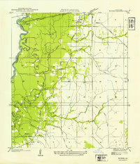
Bancroft sits at the heart of this post-war survey, a rural community defined by its proximity to the winding Sabine River border. The landscape reveals a transition from the river bottomlands to the interior timber country, marked by an extensive Old Logging Railroad Grade that speaks to the region's industrial past. The serpentine river boundary includes distinctive features like Taylor Bend and Salem Ferry, which once provided vital connectivity between Newton County, Texas and Beauregard Parish. This area is dotted with small cultural landmarks such as Friendship Ch, Brushy Creek Ch, and a local Cem, while the wetlands and oxbows of the basin are recorded through names like Lower Sydney Lake, Skinner Lakes, and Drain Lake. The map captures the alignment of State Highway No 143 as it cuts through the piney woods of western Louisiana.
Find a feature on this map
21 named features on this map. Tap any name to fly to it.
Don’t see what you’re looking for? This feature index may not catch every label — zoom into the map to look around manually.
Map Details
Editions of this 1949 Bancroft Map
This is the sole edition of this map. No revisions or reprints were ever made.
Other maps of this area

1935 · Wilson Lake
USGS Topo · 1:31,680

1947 · Carter Creek
USGS Topo · 1:31,680

1947 · Wilson Lake
USGS Topo · 1:31,680

1947 · Hyatt
USGS Topo · 1:31,680

1947 · Bivens
USGS Topo · 1:31,680

1947 · Long Marsh
USGS Topo · 1:31,680

1952 · Lake Charles
USGS Topo · 1:250,000
1954 · Bivens
USGS Topo · 1:31,680

1954 · Lake Charles
USGS Topo · 1:250,000
1955 · Hyatt
USGS Topo · 1:31,680