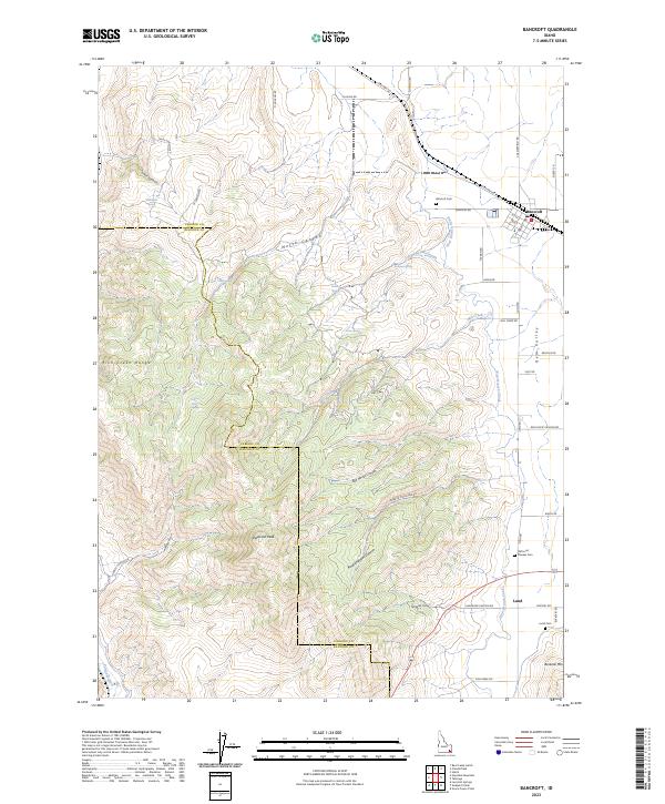
2023 Map of Bancroft
USGS Topo · Published 2023About this map
The high mountain basins and valley floors of Caribou and Bannock County meet in this topographic survey, centered on the historic agricultural hub of Bancroft. The town layout is clearly defined along Old Hwy 30 and the railroad corridor, while the small settlement of Lund sits to the south in Gem Valley. This landscape is defined by its water management and varied terrain, from the West Branch Canal irrigation network to the high elevations of Petticoat Peak and Buckskin Mtn. Local family history is preserved through numerous named sites, including the Old Lund Pioneer Cemetery and Bancroft Cemetery. The western portion of the map is dominated by the steep slopes of the Fish Creek Range, featuring several named water sources like Milkshake Spring and School House Spring, which have long supported the region's ranching and homesteading operations.
Find a feature on this map
53 named features on this map. Tap any name to fly to it.
Don’t see what you’re looking for? This feature index may not catch every label — zoom into the map to look around manually.
Map Details
Editions of this 2023 Bancroft Map
2 editions found
Other maps of this area

1917 · Portneuf
USGS Topo · 1:62,500

1948 · Bancroft
USGS Topo · 1:62,500

1949 · Bancroft
USGS Topo · 1:62,500

1954 · Pocatello
USGS Topo · 1:250,000

1955 · Preston
USGS Topo · 1:250,000

1958 · Pocatello
USGS Topo · 1:250,000

1958 · Preston
USGS Topo · 1:250,000

1962 · Preston
USGS Topo · 1:250,000

1968 · Bear Camp Gulch
USGS Topo · 1:24,000

1968 · Lava Hot Springs
USGS Topo · 1:24,000