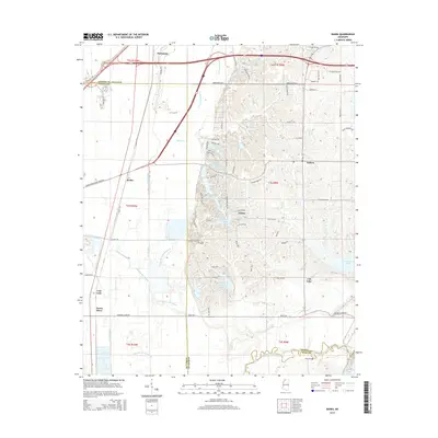
2015 Map of Banks
USGS Topo · Published 2015About this map
Marienette and Eudora anchor this 2015 survey of the northern Mississippi lowlands, where the landscape is defined by an intricate network of waterways transitioning into the Yazoo-Mississippi Delta. The terrain is marked by a complex system of bayous and drainage ditches, such as Lake Cormorant Bayou and the Big Six Ditch, which manage the flow through this flood-prone agricultural region. The presence of several distinct water bodies, including Lake Greenwood Leflore and Chief Chisca Lake, suggests a history of oxbow formation and land management near the Coldwater River. To the southeast, the map captures the western reaches of Arkabutla Lake, a significant reservoir that reshaped the local topography. For genealogists and local historians, the document provides a contemporary view of small settlements like Banks and Trinity, set against a grid of rural roads and the sprawling expansion of the Casino Strip Resort Blvd Ext.
Find a feature on this map
84 named features on this map. Tap any name to fly to it.
Don’t see what you’re looking for? This feature index may not catch every label — zoom into the map to look around manually.
Map Details
Editions of this 2015 Banks Map
This is the sole edition of this map. No revisions or reprints were ever made.
Other maps of this area

1908 · Hollywood
USGS Topo · 1:24,000

1908 · Lake Cormorant
USGS Topo · 1:24,000

1912 · Lake Cormorant
USGS Topo · 1:31,680

1913 · Hollywood
USGS Topo · 1:31,680

1931 · Horseshoe Lake
USGS Topo · 1:62,500

1932 · Horn Lake
USGS Topo · 1:48,000

1932 · Crenshaw
USGS Topo · 1:62,500

1935 · Crenshaw
USGS Topo · 1:62,500

1935 · Horn Lake
USGS Topo · 1:62,500

1939 · Clayton
USGS Topo · 1:62,500