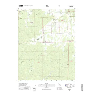
2017 Map of Banner
USGS Topo · Published 2017About this map
Mark Twain National Forest dominates the southern half of this landscape, where the terrain rises sharply toward Bell Mountain and Pruitt Mtn. The northern portion of the quadrangle shows a transition into more settled territory near Banner, characterized by a network of rural routes like State Hwy BB and Banner Rd. A high concentration of family and community burial sites, including Thomas Chapel Cem, Tullock Cem, and Nelson Cem, suggests a long-established rural population scattered among the ridges and hollows. The drainage patterns of Shut-in Cr and Imboden Fork carve deep into the Missouri highlands, while local landmarks such as Coon Hollow and Richardson provide anchor points for regional history. This 2017 survey details the topographical complexity of the Iron County and Washington County border, reflecting a landscape defined by timber, mountain peaks, and winding creek beds.
Find a feature on this map
53 named features on this map. Tap any name to fly to it.
Don’t see what you’re looking for? This feature index may not catch every label — zoom into the map to look around manually.
Map Details
Editions of this 2017 Banner Map
This is the sole edition of this map. No revisions or reprints were ever made.
Other maps of this area

1905 · Bonneterre
USGS Topo · 1:62,500

1906 · Potosi
USGS Topo · 1:62,500

1924 · Edgehill
USGS Topo · 1:62,500

1926 · Edgehill
USGS Topo · 1:62,500

1937 · Ironton
USGS Topo · 1:48,000

1945 · Ironton
USGS Topo · 1:62,500

1946 · Ironton
USGS Topo · 1:62,500

1949 · Rolla
USGS Topo · 1:250,000

1953 · Ironton
USGS Topo · 1:62,500

1953 · Rolla
USGS Topo · 1:250,000