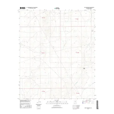
2017 Map of Bar C Bar Ranch
USGS Topo · Published 2017About this map
Bar C Bar Ranch and the surrounding high plains of Chaves County are defined by a sparse network of ranching infrastructure and drainage patterns. This 2017 survey shows a landscape dominated by the winding course of Long Arroyo, which cuts northwest across the terrain. Human presence is centered on vital water resources, including South Mill, South Tank, and N Morris Tank. The map illustrates the sprawling nature of New Mexico ranching at this date, where named landmarks are often miles apart and tied to the management of livestock. The systematic Public Land Survey System grid, including townships like t13s r28e and t14s r27e, provides the framework for these large landholdings in the arid Pecos Valley region.
Find a feature on this map
11 named features on this map. Tap any name to fly to it.
Don’t see what you’re looking for? This feature index may not catch every label — zoom into the map to look around manually.
Map Details
Editions of this 2017 Bar C Bar Ranch Map
This is the sole edition of this map. No revisions or reprints were ever made.
Other maps of this area

1949 · Wade Ranch
USGS Topo · 1:24,000

1949 · Malstrom Ranch
USGS Topo · 1:24,000

1950 · Bottomless Lakes
USGS Topo · 1:24,000

1950 · Dexter East
USGS Topo · 1:24,000

1951 · Ninemile Well
USGS Topo · 1:24,000

1951 · King Camp
USGS Topo · 1:24,000

1951 · Hagerman
USGS Topo · 1:24,000

1952 · Connor Well
USGS Topo · 1:24,000

1952 · Bar C Bar Ranch
USGS Topo · 1:24,000

1955 · Roswell
USGS Topo · 1:250,000