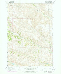
1967 Map of Bar V Ranch
USGS Topo · Published 1978About this map
The Bar V Ranch stands as a focal point in this landscape of the late 1960s, situated within a complex network of drainages in Big Horn County. The terrain is defined by the winding paths of Squirrel Creek and its North Fork Squirrel Creek, which carve through the topography alongside Youngs Creek and Tanner Creek. A significant portion of the eastern section is marked by the Crow Indian Reservation Boundary, delineating land management and sovereignty lines that have shaped the region's historical development.
Find a feature on this map
12 named features on this map. Tap any name to fly to it.
Don’t see what you’re looking for? This feature index may not catch every label — zoom into the map to look around manually.
Map Details
Editions of this 1967 Bar V Ranch Map
2 editions found
Other maps of this area

1894 · Rosebud
USGS Topo · 1:125,000

1895 · Dayton
USGS Topo · 1:125,000

1901 · Rosebud
USGS Topo · 1:125,000

1901 · Dayton
USGS Topo · 1:125,000

1909 · Sheridan
USGS Topo · 1:125,000

1911 · Sheridan
USGS Topo · 1:125,000

1954 · Hardin
USGS Topo · 1:250,000

1955 · Sheridan
USGS Topo · 1:250,000

1957 · Hardin
USGS Topo · 1:250,000

1958 · Hardin
USGS Topo · 1:250,000