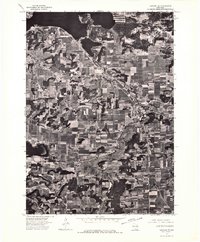
1974 Map of Baraboo SE
USGS Topo · Published 1976About this map
Lake Wisconsin and the sweeping Wisconsin River dominate the northern landscape of this mid-1970s orthophotograph, where the water's edge meets a patchwork of structured farmland. The city of Lodi serves as the primary inland hub, its street grid and residential expansion clearly visible against the surrounding agricultural fields. This aerial-based survey provides a precise visual record of land use at a time when the boundary near Dane Co was defined by distinct rural-to-urban transitions. The imagery captures the physical relationship between the river valley and the development patterns of the region, offering a clear view of the area's geography before decades of modern development altered the woodland and field boundaries.
Find a feature on this map
4 named features on this map. Tap any name to fly to it.
Don’t see what you’re looking for? This feature index may not catch every label — zoom into the map to look around manually.
Map Details
Editions of this 1974 Baraboo SE Map
This is the sole edition of this map. No revisions or reprints were ever made.
Other maps of this area

1890 · Madison
USGS Topo · 1:62,500

1892 · Madison
USGS Topo · 1:62,500

1895 · Baraboo
USGS Topo · 1:62,500

1901 · Poynette
USGS Topo · 1:62,500

1904 · Madison
USGS Topo · 1:62,500

1906 · Madison
USGS Topo · 1:62,500

1907 · Cross Plains
USGS Topo · 1:62,500

1908 · Baraboo
USGS Topo · 1:62,500

1909 · Cross Plains
USGS Topo · 1:62,500

1957 · Madison
USGS Topo · 1:250,000