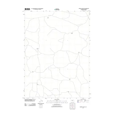
2011 Map of Barent Valley
USGS Topo · Published 2011About this map
Barent Valley and Dry Valley characterize this section of the Nebraska Sandhills, where the landscape is defined by vast depressions and the scattered ranching operations that utilize them. The map documents the spatial arrangement of historic landholdings in Cherry County, specifically noting Swendener Ranch, Walker Ranch, and Phillips Ranch. These sprawling sites, connected by networks of local roads like Dry Valley Rd, represent the enduring cattle-ranching economy of the region. For those tracing family histories or land use, the inclusion of James Cemetery near the southern boundary provides a specific point of interest for genealogical research within this sparsely populated terrain. The distribution of Murry Ranch and Giles Ranch further illustrates the isolated nature of these rural homesteads, each anchored to the specific geography of the valleys they inhabit.
Find a feature on this map
9 named features on this map. Tap any name to fly to it.
Don’t see what you’re looking for? This feature index may not catch every label — zoom into the map to look around manually.
Map Details
Editions of this 2011 Barent Valley Map
This is the sole edition of this map. No revisions or reprints were ever made.
Other maps of this area

1948 · Seneca
USGS Topo · 1:62,500

1948 · Mullen
USGS Topo · 1:62,500

1949 · Big Falls
USGS Topo · 1:62,500

1951 · Mullen
USGS Topo · 1:62,500

1951 · Seneca
USGS Topo · 1:62,500

1951 · Big Falls
USGS Topo · 1:62,500

1951 · Bull Lake
USGS Topo · 1:62,500

1957 · Valentine
USGS Topo · 1:250,000

1959 · Valentine
USGS Topo · 1:250,000

1985 · Mullen
USGS Topo · 1:100,000