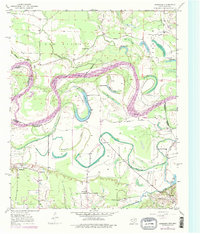
1950 Map of Barkman
USGS Topo · Published 1976About this map
Red River meanders across the borderlands between Arkansas and Texas, carving a complex landscape of oxbow lakes and shifting channels. This mid-century survey reveals the hydraulic character of the region, where the river's former paths remain as named features like The Old Sag, Old River Lake, and Roseborough Lake. The boundary between Arkansas and Texas follows the river's winding course, while the southern portion of the map shows the transition into more stable settlement patterns. Rural life is anchored by local landmarks such as St Lukes Ch and Mt Zion Ch, while the community of Barkman sits near the banks of McKinney Bayou. The intricate drainage network is further shaped by the Diversion Canal and numerous smaller water bodies like Grassy Lake and Rush Lake, reflecting the constant management of this flood-prone river bottom environment.
Find a feature on this map
28 named features on this map. Tap any name to fly to it.
Don’t see what you’re looking for? This feature index may not catch every label — zoom into the map to look around manually.
Map Details
Editions of this 1950 Barkman Map
5 editions found
Other maps of this area

1909 · New Boston
USGS Topo · 1:62,500

1909 · Texarkana
USGS Topo · 1:62,500

1950 · Redbank
USGS Topo · 1:24,000

1950 · Ashdown East
USGS Topo · 1:24,000

1950 · Ashdown West
USGS Topo · 1:24,000

1950 · Ogden
USGS Topo · 1:24,000

1950 · Barkman
USGS Topo · 1:24,000

1951 · Redbank
USGS Topo · 1:24,000

1951 · Ashdown West
USGS Topo · 1:24,000

1951 · Ogden
USGS Topo · 1:24,000