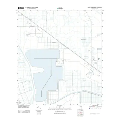
2012 Map of Barley Barber Swamp
USGS Topo · Published 2012About this map
Barley Barber Swamp dominates this landscape in western Martin County, appearing as a significant water body and wetland complex. The surrounding area is defined by a grid of agricultural and residential access roads, reflecting the region's managed landscape in the early 21st century. Small settlements such as Zana in the northwest and Bessemer near the southern edge provide local anchors within this largely rural expanse. Aviation interest is notable here, with both Horseshoe Acres Airpark and Coxs Hammock Airport present on the sheet.
Find a feature on this map
23 named features on this map. Tap any name to fly to it.
Don’t see what you’re looking for? This feature index may not catch every label — zoom into the map to look around manually.
Map Details
Editions of this 2012 Barley Barber Swamp Map
This is the sole edition of this map. No revisions or reprints were ever made.
Other maps of this area

1953 · Okeechobee 4 SW
USGS Topo · 1:24,000

1953 · Okeechobee 4 SE
USGS Topo · 1:24,000

1953 · Okeechobee 4 NE
USGS Topo · 1:24,000

1953 · Okeechobee 4 NW
USGS Topo · 1:24,000

1953 · Indian Town NW
USGS Topo · 1:24,000

1953 · Indian Town
USGS Topo · 1:24,000

1956 · West Palm Beach
USGS Topo · 1:250,000

1956 · Fort Pierce
USGS Topo · 1:250,000

1957 · West Palm Beach
USGS Topo · 1:250,000

1958 · Fort Pierce
USGS Topo · 1:250,000