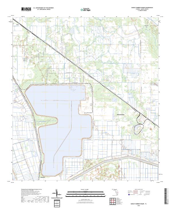
2024 Map of Barley Barber Swamp
USGS Topo · Published 2024About this map
The Saint Lucie Canal and Okeechobee Waterway dominate the southern landscape of this Martin County interior, where industrial water management meets the natural wetlands of Barley Barber Swamp. This area is characterized by a transition from the agricultural and residential outskirts of Indiantown to the more open Allapattah Flats. The presence of the Florida East Coast rail line and numerous local roads, such as SW Fox Brown Rd and SW Farm Rd, reveals a highly organized land-use pattern typical of Florida's inland drainage districts. Small settlements like Bessemer and Zana sit at the periphery of larger parcels, while specialized features like the Horseshoe Acres Airpark reflect the low-density, rural-residential developments of the early 21st century. Conservation and recreation efforts are evident in the Dupuis Reserve Trl, which meanders through the southern portions of the territory.
Find a feature on this map
32 named features on this map. Tap any name to fly to it.
Don’t see what you’re looking for? This feature index may not catch every label — zoom into the map to look around manually.
Map Details
Editions of this 2024 Barley Barber Swamp Map
This is the sole edition of this map. No revisions or reprints were ever made.
Other maps of this area

1953 · Okeechobee 4 SW
USGS Topo · 1:24,000

1953 · Okeechobee 4 SE
USGS Topo · 1:24,000

1953 · Okeechobee 4 NE
USGS Topo · 1:24,000

1953 · Okeechobee 4 NW
USGS Topo · 1:24,000

1953 · Indian Town NW
USGS Topo · 1:24,000

1953 · Indian Town
USGS Topo · 1:24,000

1956 · West Palm Beach
USGS Topo · 1:250,000

1956 · Fort Pierce
USGS Topo · 1:250,000

1957 · West Palm Beach
USGS Topo · 1:250,000

1958 · Fort Pierce
USGS Topo · 1:250,000