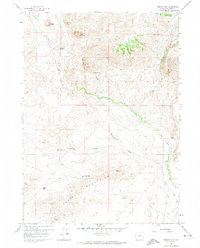
1959 Map of Barlow Gap
USGS Topo · Published 1974About this map
Granite Mountains peaks and high desert plains define this 1950s landscape in Natrona County, where isolated cattle operations represent the primary human imprint. The terrain is marked by high-altitude features like Goat Mountain and Bald Mountain, while the drainage of Dry Creek and Barlow Springs Draw carves through the arid flats. Cultural markers are centered on legacy ranching operations, including the Circle Bar Ranch and the Seven D Ranch.
Find a feature on this map
19 named features on this map. Tap any name to fly to it.
Don’t see what you’re looking for? This feature index may not catch every label — zoom into the map to look around manually.
Map Details
Editions of this 1959 Barlow Gap Map
3 editions found
Other maps of this area

1951 · Lone Mountain
USGS Topo · 1:24,000

1952 · Ervay Basin SW
USGS Topo · 1:24,000

1955 · Casper
USGS Topo · 1:250,000

1958 · Casper
USGS Topo · 1:250,000
1959 · Stinking Water Creek
USGS Topo · 1:24,000

1959 · Saddle Rock
USGS Topo · 1:24,000

1959 · Miller Spring
USGS Topo · 1:24,000

1959 · Blackjack Ranch
USGS Topo · 1:24,000

1959 · Barlow Gap
USGS Topo · 1:24,000
1959 · Garfield Peak
USGS Topo · 1:24,000