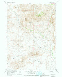
1959 Map of Barlow Gap
USGS Topo · Published 1991About this map
The Granite Mountains dominate the southern half of this landscape, creating a series of topographic bottlenecks and passes. Among these are Crilly Gap and the namesake Barlow Gap, which provide natural transit points through the high terrain. The area's mid-century ranching footprint is visible through family-named sites like Circle Bar Ranch, Clayton Ranch, and the Seven D Ranch. A notable point of historical interest is the Vide Homestead (Abandoned) located near McDougal Gulch, which, alongside an isolated Airstrip and Racetrack, suggests a landscape of remote self-sufficiency and utilitarian land use.
Find a feature on this map
21 named features on this map. Tap any name to fly to it.
Don’t see what you’re looking for? This feature index may not catch every label — zoom into the map to look around manually.
Map Details
Editions of this 1959 Barlow Gap Map
3 editions found
Other maps of this area

1951 · Lone Mountain
USGS Topo · 1:24,000

1952 · Ervay Basin SW
USGS Topo · 1:24,000

1955 · Casper
USGS Topo · 1:250,000

1958 · Casper
USGS Topo · 1:250,000
1959 · Stinking Water Creek
USGS Topo · 1:24,000

1959 · Saddle Rock
USGS Topo · 1:24,000

1959 · Miller Spring
USGS Topo · 1:24,000

1959 · Blackjack Ranch
USGS Topo · 1:24,000

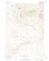
1959 · Barlow Gap
USGS Topo · 1:24,000
1959 · Garfield Peak
USGS Topo · 1:24,000