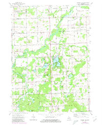
1963 Map of Barnes Lake
USGS Topo · Published 1980About this map
Barnes Lake and its surrounding wetlands form the center of this Lapeer County landscape during the early 1960s. The area is defined by a dense cluster of kettle lakes, including Millers Lake, Littlefield Lake, and Dipper Lake, many of which supported emerging residential pockets like the one found at Barnes Lake. Educational and spiritual life is marked by the Millis Sch and the Deerfield Church of Christ, providing clear points of reference for genealogists tracing families near the small settlements of West Deerfield and Maxwell. Much of the western terrain is dedicated to the Lapeer State Game Area, illustrating a transition toward conservation and recreation. The geography is further organized by the winding courses of the North Branch Flint River and South Branch Flint River, which dictated the early road network and the placement of numerous gravel pits found throughout the township.
Find a feature on this map
91 named features on this map. Tap any name to fly to it.
Don’t see what you’re looking for? This feature index may not catch every label — zoom into the map to look around manually.
Map Details
Editions of this 1963 Barnes Lake Map
2 editions found
Other maps of this area

1954 · Flint
USGS Topo · 1:250,000

1958 · Flint
USGS Topo · 1:250,000

1963 · Clifford
USGS Topo · 1:24,000

1963 · Attica
USGS Topo · 1:24,000

1963 · Mayville
USGS Topo · 1:24,000

1963 · North Branch
USGS Topo · 1:24,000

1963 · Columbiaville
USGS Topo · 1:24,000

1963 · Elba
USGS Topo · 1:24,000

1963 · Juniata
USGS Topo · 1:24,000
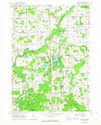
1963 · Barnes Lake
USGS Topo · 1:24,000
Featured Places
- Mayfield Township, MI
- Watertown Township, MI
- Oregon Township, MI
- Marathon Township, MI
- Rich Township, MI