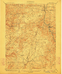
1904 Map of Barnesboro
USGS Topo · Published 1911About this map
Barnesboro and Spangler serve as the primary industrial hubs in this turn-of-the-century look at the Pennsylvania coal and timber country. The landscape is heavily defined by its drainage basins and early transportation corridors, most notably the Pennsylvania R R and its Cambria and Clearfield Division, which follow the winding path of the West Branch Susquehanna River.
Find a feature on this map
87 named features on this map. Tap any name to fly to it.
Don’t see what you’re looking for? This feature index may not catch every label — zoom into the map to look around manually.
Map Details
Editions of this 1904 Barnesboro Map
5 editions found
Other maps of this area

1902 · Indiana
USGS Topo · 1:62,500

1902 · Ebensburg
USGS Topo · 1:62,500

1902 · Patton
USGS Topo · 1:62,500

1902 · Barnesboro
USGS Topo · 1:62,500

1903 · Curwensville
USGS Topo · 1:62,500

1904 · Barnesboro
USGS Topo · 1:62,500

1904 · Patton
USGS Topo · 1:62,500

1904 · Ebensburg
USGS Topo · 1:62,500

1904 · Johnstown
USGS Topo · 1:62,500

1906 · Punxsutawney
USGS Topo · 1:62,500
Featured Places
- Northern Cambria, PA
- Rayne Township, PA
- Brush Valley Township, PA
- Cherry Tree, PA
- East Carroll Township, PA