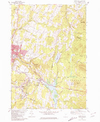
1981 Map of Barre East
USGS Topo · Published 1981About this map
The industrial soul of central Vermont is on full display here, dominated by the extensive Barre Granite Quarries and the surrounding worker settlements. The landscape transitions from the urban edge of Barre into a rugged upland of extraction, where Websterville, Graniteville, and Upper Graniteville cluster around deep pits and massive quarries on Millstone Hill. This concentration of industry shaped the region's social fabric, evident in the numerous community landmarks like St Sylvester and Spaulding High Sch.
Find a feature on this map
65 named features on this map. Tap any name to fly to it.
Don’t see what you’re looking for? This feature index may not catch every label — zoom into the map to look around manually.
Map Details
Editions of this 1981 Barre East Map
2 editions found
Other maps of this area

1919 · Montpelier
USGS Topo · 1:62,500

1921 · Montpelier
USGS Topo · 1:62,500

1922 · Barre
USGS Topo · 1:48,000

1924 · Barre
USGS Topo · 1:62,500

1939 · Plainfield
USGS Topo · 1:48,000

1940 · Plainfield
USGS Topo · 1:62,500

1943 · Plainfield
USGS Topo · 1:62,500

1944 · Montpelier
USGS Topo · 1:62,500

1947 · Corinth
USGS Topo · 1:62,500

1948 · East Barre
USGS Topo · 1:62,500