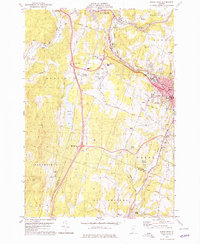
1978 Map of Barre West
USGS Topo · Published 1979About this map
The Winooski River and Montpelier and Barre railroad corridor anchor this late 1970s landscape, illustrating the industrial and transportation infrastructure connecting Vermont's capital with its neighbors. The map reveals the layout of Barre and Montpelier as they appeared before modern expansion, featuring a high density of civic landmarks including the Edward F Knapp Airport, the Hosp, and several radio towers.
Find a feature on this map
64 named features on this map. Tap any name to fly to it.
Don’t see what you’re looking for? This feature index may not catch every label — zoom into the map to look around manually.
Map Details
Editions of this 1978 Barre West Map
3 editions found
Other maps of this area

1919 · Montpelier
USGS Topo · 1:62,500

1921 · Montpelier
USGS Topo · 1:62,500

1922 · Barre
USGS Topo · 1:48,000

1924 · Barre
USGS Topo · 1:62,500

1939 · Plainfield
USGS Topo · 1:48,000

1940 · Plainfield
USGS Topo · 1:62,500

1943 · Plainfield
USGS Topo · 1:62,500

1944 · Montpelier
USGS Topo · 1:62,500

1947 · Corinth
USGS Topo · 1:62,500

1948 · East Barre
USGS Topo · 1:62,500