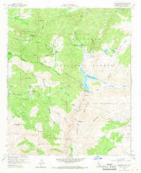
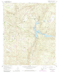
1960 Map of Barrett Lake
USGS Topo · Published 1968About this map
Barrett Lake and its significant Barrett Dam Spillway serve as the central focus of this mid-century survey of the Cleveland National Forest. The landscape is defined by its water management and ranching history, featuring the Barrett Honor Camp and private holdings like Eichenlaub Ranch, Walker Ranch, and Bratton Ranch. These ranch sites are often tucked into valleys such as Lyons Valley or along the Deerhorn Grade. High peaks including Lawson Peak and Mother Grundy Peak overlook a network of canyons, most notably Pats Canyon and Rattlesnake Canyon. A distinctive Conduit, Tramway, and Tunnel system traces the path of Cottonwood Creek and Echo Creek, indicating the sophisticated infrastructure required to move water through this mountain terrain. For genealogists and local historians, the map preserves the exact locations of many named springs and remote Jeep Trails that connected these early back-country settlements.
Find a feature on this map
53 named features on this map. Tap any name to fly to it.
Don’t see what you’re looking for? This feature index may not catch every label — zoom into the map to look around manually.
Map Details
Editions of this 1960 Barrett Lake Map
5 editions found
Other maps of this area

1893 · El Cajon
USGS Topo · 1:62,500

1901 · Elcajon
USGS Topo · 1:62,500

1903 · Cuyamaca
USGS Topo · 1:125,000

1903 · Elcajon
USGS Topo · 1:62,500

1904 · Southern California Sheet No. 2
USGS Topo · 1:250,000

1939 · El Cajon
USGS Topo · 1:62,500

1942 · Potrero
USGS Topo · 1:48,000

1942 · El Cajon
USGS Topo · 1:62,500

1942 · Cuyamaca Peak
USGS Topo · 1:62,500

1943 · Jamul
USGS Topo · 1:62,500